Drone prescription maps in wheat farming become valuable only when they help a team decide what to do next. A sharp image alone is not the outcome. The real outcome is whether drone capture, agronomic logic, and machinery-ready outputs can support a more targeted protection decision at the right moment.
That is the practical angle behind the AgriDrone project, in which AGRIVI and Skyline Drones integrate field imaging, analytics, and prescription mapping into a single, usable workflow.
This version of the story examines the period that comes after capture. Instead of repeating the general early-detection narrative, it focuses on how imagery is translated into field zones, prescription maps, and action inside day-to-day wheat operations.
Project Snapshot
AgriDrone is a Eurostars project under Horizon Europe, project code EUROSTARS-3-E!4126-AgriDrone:
- It runs from 1 April 2024 to 31 March 2026, lasts 24 months
- Has a total budget of EUR 732.841
- Brings together two partners: AGRIVI and Skyline Drones from Romania
- The project sits within the field of specialization 3 – Food, bioeconomy, natural resources, biodiversity, agriculture, and environment
- Agency for SMEs, Innovation and Investments (HAMAG-BICRO) co-finances the project through the Eurostars programme.
Project Objectives
The project has two main objectives:
- First, it strengthens AI-driven detection of Fusarium head blight and Septoria leaf blotch. AGRIVI enriches its existing model with high-resolution drone imagery and field data, so teams can detect infections earlier and more precisely.
- Second, it supports advanced variable rate application. The workflow uses multispectral capture, vegetation indices, and wheat prescription maps that compatible machinery can use in the field.
In practical terms, the expected outcome is a workflow that produces wheat prescription maps that help farmers and agronomists detect pressure earlier, target interventions more precisely, reduce unnecessary pesticide use, and support preventive crop-protection decisions with stronger data layers.
Why Imagery Without Action is Not Enough
Agricultural teams do not need another image library. They need a clearer next step. When wheat protection decisions depend on timing, local conditions, and machinery execution, the useful question is not just “Can the drone see something?” The useful question is “Can the system turn what it sees into a field instruction that can actually be used?”
That is where AgriDrone becomes operational rather than purely analytical.
The project does not aim to visualize crop variability for presentation purposes. It turns drone-derived signals into decision support for scouting prioritization, treatment targeting, and variable rate application.
How the AgriDrone Workflow Moves from Flight to Field Decision
How Wheat Prescription Maps Are Built
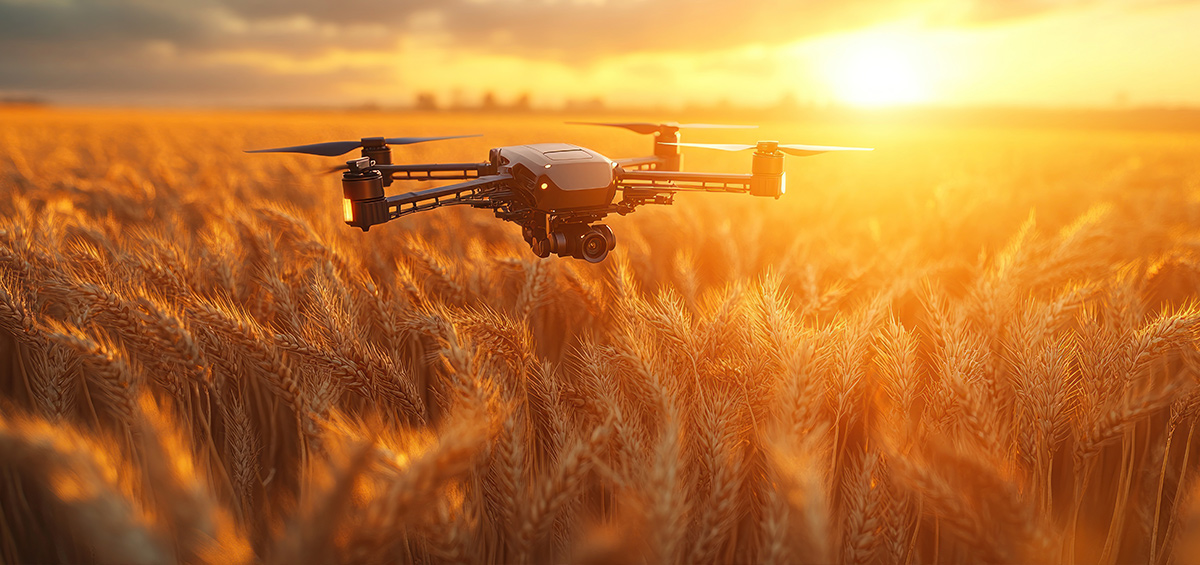
The workflow starts with drone missions scheduled around relevant crop stages and field conditions. Skyline Drones captures high-resolution imagery with advanced sensors, including multispectral and thermal capabilities, so the system can read more than a standard visual inspection would reveal.
AGRIVI then combines those inputs with other operational layers, including satellite imagery, weather data, and disease-development logic. A single image does not tell the full agronomic story. The strongest signal appears when the platform reads field imagery together with environmental context and crop timing.
From there, the workflow shifts from observation to zoning. Vegetation indices and other derived indicators help separate the field into areas that behave differently. Instead of treating the parcel as one uniform surface, the system can identify micro-variations that may require a different level of attention or a different application rate.
The next step creates the business value: the workflow turns those insights into wheat prescription maps for field use. Compatible tractor terminals and machinery systems can read those outputs. At that point, analytics stop being a report and start guiding execution.
Why Wheat Prescription Maps Matter
Wheat prescription maps matter because they bridge analysis and action. When some field zones show higher pressure or stronger stress signals, a blanket treatment across the whole parcel is not always the best answer. Map-based instructions let teams apply inputs according to real field variability, not default habits.
In practice, this supports more targeted use of fungicides and other crop-protection inputs. It can also improve the quality of field conversations between agronomists, machine operators, and farm managers because everyone works from the same spatial logic instead of from a general impression of the parcel.
For wheat producers, that matters most when protection windows are narrow. A system that localizes pressure more precisely and translates it into an executable field layer can support faster and more disciplined decisions during the season.
What the Pilots Validate for Wheat Prescription Maps
The AgriDrone pilots are not only about asking whether the algorithm can improve detection; they also test whether the overall workflow is usable under real production conditions. Across the two pilot cycles, field data have been used to refine how drone capture, agronomic interpretation, and machinery-ready output work together in practice.
That includes very practical questions – are the zones meaningful enough for a farmer or agronomist to trust them? Is the output timed well enough to matter in the season? Can the prescription map be used without creating extra friction for the operator? Does the workflow improve decisions, not just analytics?
Those questions are important because digital agriculture fails fast when it creates elegant dashboards but clumsy execution. Practical adoption depends on whether the insight can move cleanly from screen to field operation.
Who Does What in the Project
AGRIVI is the lead partner and is responsible for advancing the AI logic, integrating drone-image processing into the farm-management workflow, supporting variable rate application, and building prescription-map functionality inside the platform. The company also leads piloting activities, field-data collection, and ongoing model refinement.
Skyline Drones contributes to the field-capture side of the workflow. That includes drone flights during critical wheat stages, acquisition of high-resolution multispectral imagery, technical expertise on capture specifications, and delivery of field data needed for interpretation, validation, and execution planning.
The collaboration works because the two roles are complementary. One side strengthens the sensing layer, the other turns that layer into agronomic logic and software output that can support real operational decisions.
Why This Matters for the Practical Adoption of Digital Agriculture
A lot of agtech content stops at “better visibility.” That is not enough. Practical adoption usually depends on whether a technology reduces uncertainty, saves time, improves targeting, or strengthens cost control. AgriDrone is more relevant when explained through that lens. If wheat prescription maps help create better field execution, then their value is not abstract.
If drone imagery helps create better prescription maps, then its value is not abstract. It supports a more disciplined use of inputs, a clearer response to field variability, and a stronger link between digital analysis and physical execution. That is the kind of progress farm teams can actually use.
For that reason, the project should be read not only as a story about sensing technology, but as a story about operational translation: how better field capture can become better field action.
If you want a broader view of variable rate application and precision input management, you can also explore AGRIVI’s article on precision agriculture and the Skyline Drones project.